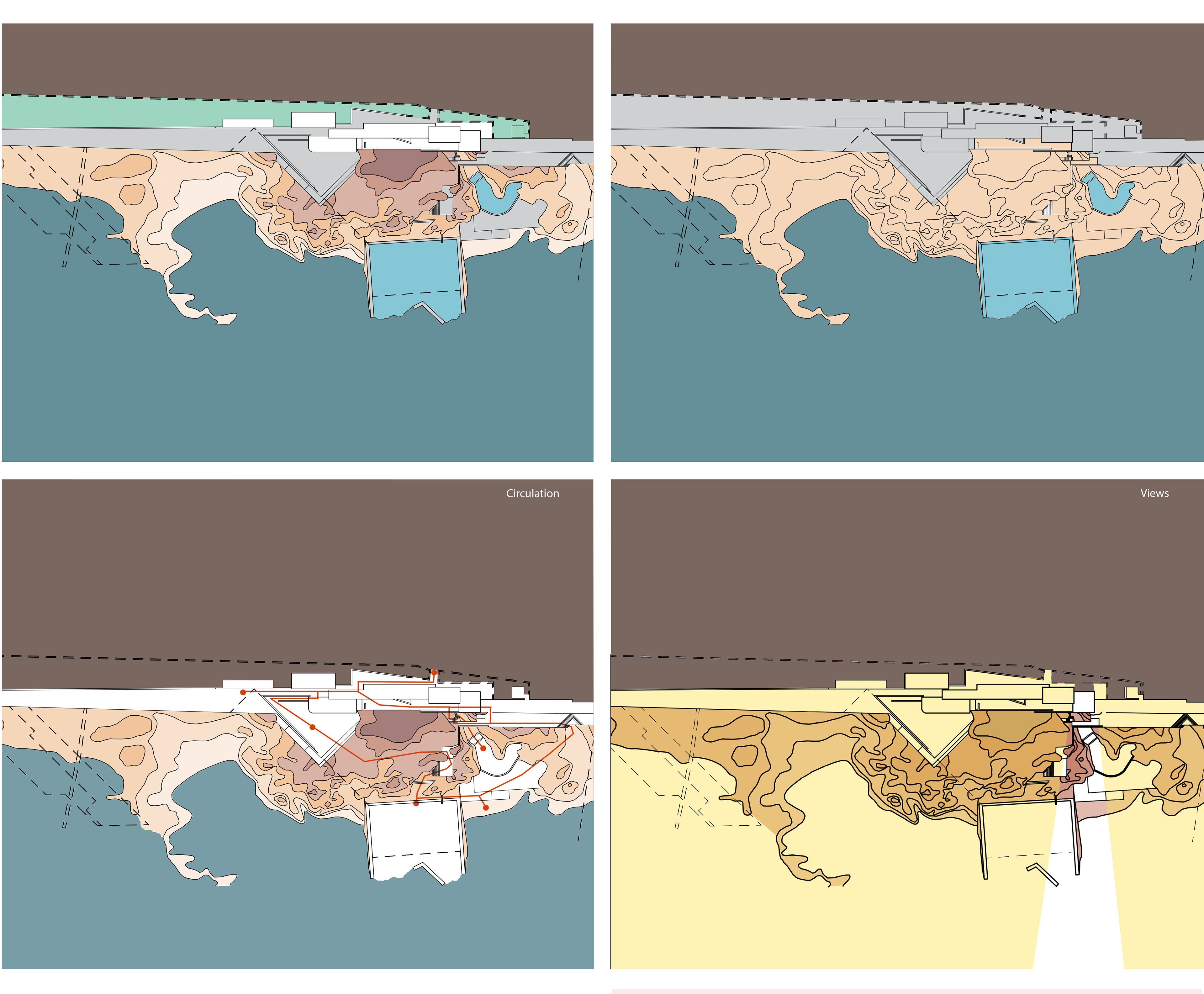
While analyzing this project we determined that the most important aspect was that it acted as a seam between the urban environment of leca Portugal and the Atlantic ocean. Therefore most of our diagrams depicted some rendition of blending or relating the urban environment to the ocean.
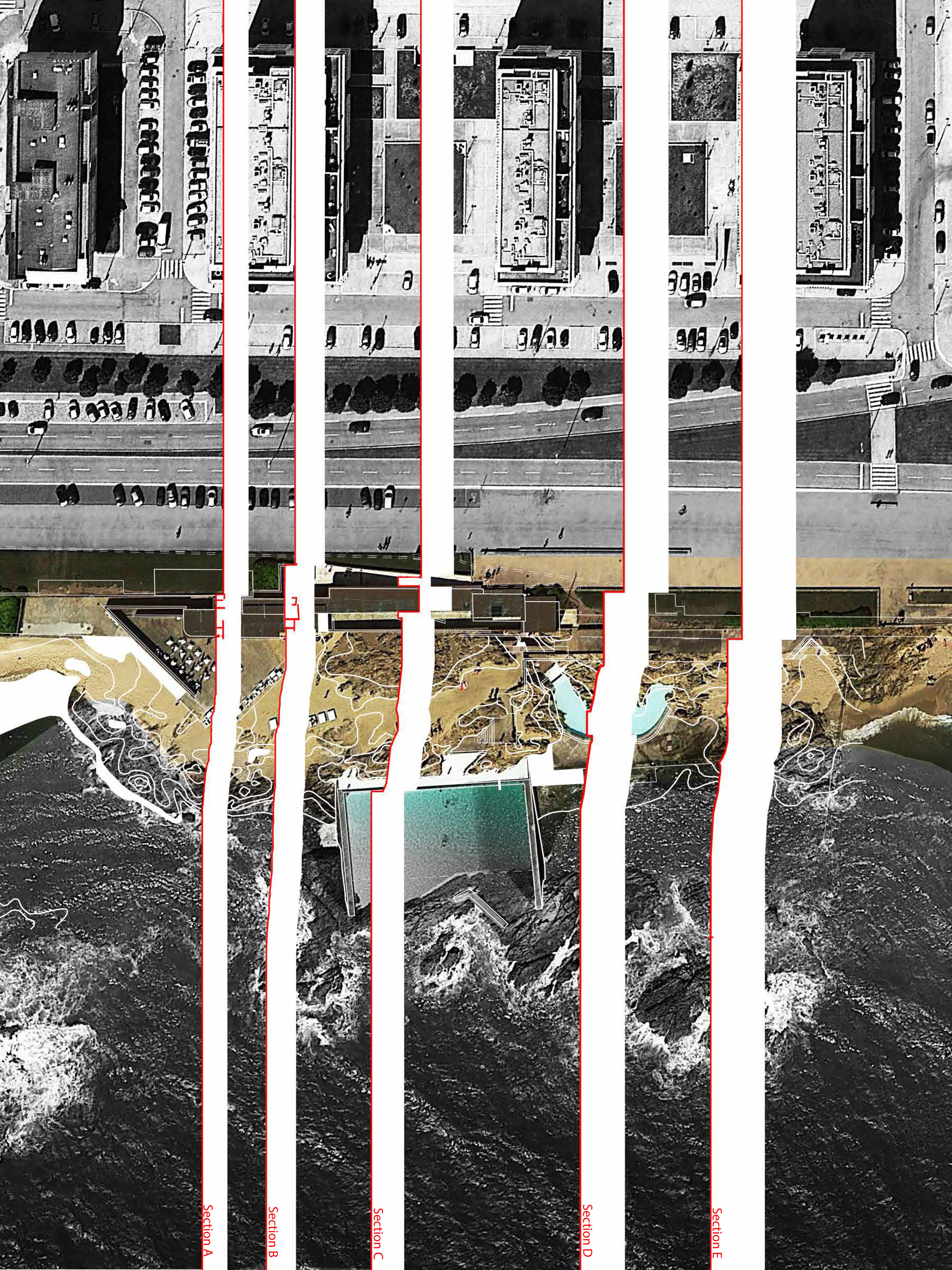
In the mapping portion of this assignment i used some techniques learned from our earlier mapping assignment to map the project. The maps i chose to use were carefully chosen to show the city in the background. I did this because all images i could find of this project would frame it as a lone piece of architecture on an obscure coastline somewhere, which I thought detracted from the idea of it acting as a seam between the city and the coastline. I decided that section would be one of the most effective tools for this project as it would represent the topographic decent better than a plan. So I overlaid the sections and pulled the map apart along those lines to emphasize the terrain development.

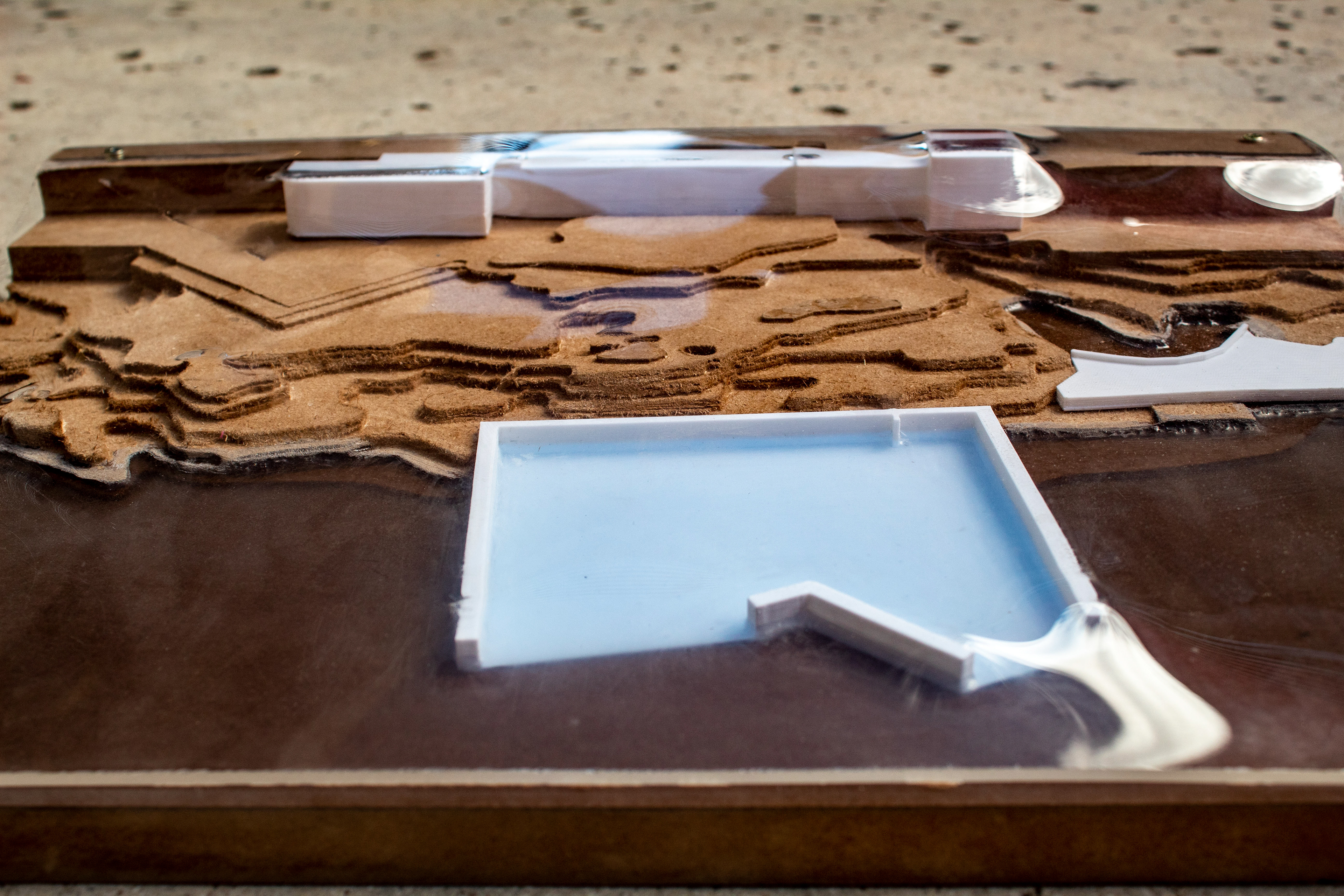
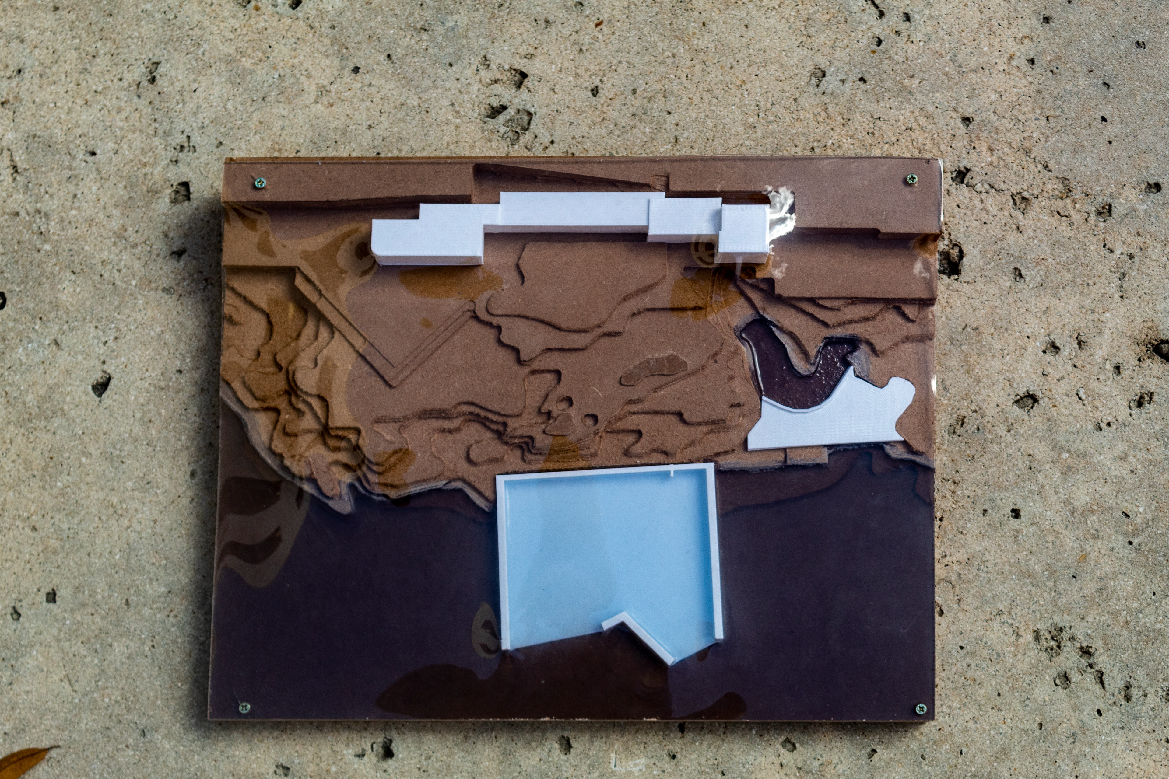
In my model for this project I used the CNC to mill the topography by itself to create a base layer for the project. Then I 3D printed the pools to visually separate the pools from the landscape and emphasize their importance. I then used resin to represent the ocean, due to the fact that the pool blends with the ocean I modeled a base for the pool so when the resin was poured over it it would read separate from the ocean. Finally, I vacuum formed a sheet of Plexiglas over a model with the buildings to add a final layer that would represent the buildings blending into the topography to create a seam between the higher
elevation and the coastline.
elevation and the coastline.